Burton Hastings
Copston Magna
Stretton Baskerville
Withybrook
Wolvey
Wolvey
a brief history
Prehistoric
times
A
number of stone tools discovered in the Wolvey area date to the earliest
stages of Lower Palaeolithic before or at the outset of the Anglian
glaciation. Radioactive dating gives a date of about 500,000 years ago.
The landscape of the area at that time was totally different and likely to
have been in the basin of the Bytham River, which drained into the North
Sea. It was Britains largest river. The rivers wide banks may have
provided the route into Britain from the continent for these early
inhabitants. We do not know exactly how or where they lived as their tools
have been recovered from the debris of subsequent glaciation. There is no
evidence of activity then until after the Ice Age when the Mesolithic
hunters and fishers left some of their flint tools along the Anker
valley.
By this time
the landscape was much as we know it today with sand and gravel soils on
the higher ground of the village and heavy boulder clay to the south which
would probably have been forested at that time. Access
to Wolvey then would most likely have been along the tributaries of three important rivers
which rise in the Wolvey area. These tributaries, the Anker (leading to the Tame and the Trent),
the Little Soar (to the Soar and the
Trent) and the Withybrook stream which joins the Sowe
and eventually the
Evidence of Late Neolithic and Bronze Age activity, some four thousand years ago, is abundant on the well-drained and easily managed sand and gravel soils. In contrast little is found on the boulder clay to the south, which was probably forested at that time. A number of fields have yielded evidence of flint tools, some stray finds but others more likely to represent flint-knapping sites; it appears that the flint was brought to the area to be worked into tools for the local community. The tools include arrowheads, knives and scrapers, indicating that hunting and the preparation of animal skins took place here. A number of mounds in the area, built of turf, cover the burials of some of Wolveys Bronze Age inhabitants. Ring ditches and possible henge monuments also occur in the area which may have been for burial as well as ritual purposes.
Roman
times
Aerial
photography reveals that there were Iron Age and Roman farmsteads in the
area. There are also two roads which were built by the Roman army early in
the occupation. The Fosse Way, connected Exeter with Lincoln and was
probably built on an existing trackway; it formed the first Roman frontier
following the invasion in AD43. The other road is Watling Street which
connected Richborough on the Channel coast via London with Wroxeter and so
into Wales and the north. Both roads are included in the 3rd century AD
Antonine Itinerary of routes throughout the Roman Empire. Thus,
Wolvey has been strategically
placed in the national road network since Roman times.
At the intersection of the two roads, the Roman settlement of Venonis (now
High Cross) developed. It was on Watling Street that Boudicca,
queen of one of the British tribes was defeated by the Romans, probably
not far from Wolvey.
Dark
Ages
Little is
known about the area in Anglo-Saxon times. By the tenth century AD, the
Watling Street formed the boundary between the Anglo-Saxon and the Danelaw
lands. The Domesday Book of 1086 indicates
that Aethelric held land in Wolvey before the Norman conquest and also that
there were a number of other settlements in the area.
The name of Wolvey - Ulveia - is
also recorded for the first time in the Domesday Book which tells of
arable, pasture and meadow there and indicates there were 22 households
including a priest and therefore presumably a church.
The earliest part of the fabric of the present church is a 12th
century doorway. Wolvey was prosperous enough
by this time to provide a
weekly market for the area. It was
also the scene of an annual fair on St Mark's Day, a tradition which
continued into the 19th century.
There
were other settlements within the parish; one with its own chapel, known
as Little Copston, long since disappeared, while another, recorded in the
Domesday Book was Bramcote (Brancote).
They were agricultural communities, arable and pasture, with
supporting crafts like smiths and millers, and operated within the feudal
system. Much of the land
was farmed for the benefit of Combe Abbey;
one farm at Wolvey, which included a large fish pond, had been
given for the benefit of the Knights Templar in 1257 hence the current
name of
Dissolution
of the monasteries
Such land was removed from the
religious orders following the dissolution of the monasteries in the
mid-sixteenth century. The
manorial system however continued with strips of land cultivated by
copyhold tenants in an open field system with shared grazing areas,
controlled by two Lords of the Manor, the Marow and Astley families.
This system lasted for another two hundred years until changes in
farming practice led to the enclosure awards in Wolvey of 1797.
Towards
the modern Wolvey
It is from this time a number of features associated with
modern Wolvey begin to emerge. The road pattern as we know it today was
laid out. A school was
established by the Vicar of Wolvey for poor children about 1784 and the
Baptist Chapel was built 1789. By
this time the industrial revolution was leaving its mark on rural Wolvey
both in farming and in the work of its inhabitants.
The 1841 census lists 742 people and records more people employed in framework knitting
than in farming; farm labouring brought in about nine shillings a week;
knitters could earn up to 12 shillings a week. Thus the Leicestershire
hosiery industry impacted on Wolvey although about mid-century some silk
ribbon weaving was being undertaken, most likely linked to the
By the end of the century
Wolvey's population had grown to 923 inhabitants, the majority living from
farming and its support services; there was a village smithy and a wheelwright but also a
number of traders in Wolvey: butchers, bakers, grocers, coal dealers and
other shopkeepers.
A
note on Wolvey's windmills
 Wolvey has been regarded as a place with many windmills in earlier times.
Arthur Mee claimed
in his book on Warwickshire, published in 1936, that Wolvey "was a thriving town of knitters and
millers in the Middle Ages, with 27 windmills vaunting their sails" . There is, however,
no documentary or archaeological evidence to support this claim. A deed
records one windmill on the Temple Manor estate in the 16th century. The
only other firm evidence relates to a windmill, transported from Shepshed,
Leicestershire and re-erected at Wolvey on a site behind the present-day
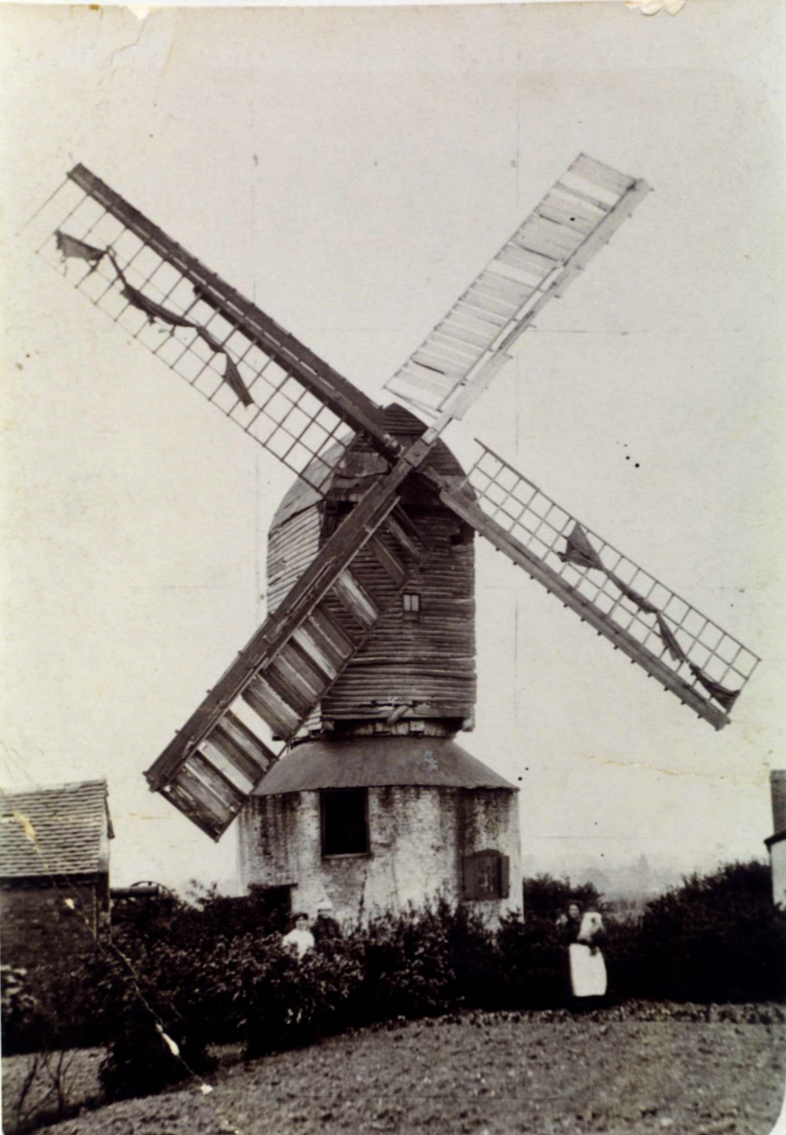
Mill Row in 1815. This can be seen in the photograph (left). It was demolished in 1909.
Wolvey has been regarded as a place with many windmills in earlier times.
Arthur Mee claimed
in his book on Warwickshire, published in 1936, that Wolvey "was a thriving town of knitters and
millers in the Middle Ages, with 27 windmills vaunting their sails" . There is, however,
no documentary or archaeological evidence to support this claim. A deed
records one windmill on the Temple Manor estate in the 16th century. The
only other firm evidence relates to a windmill, transported from Shepshed,
Leicestershire and re-erected at Wolvey on a site behind the present-day
Mill Row in 1815. This can be seen in the photograph (left). It was demolished in 1909.
In
1854 Thomas Dugdale published an engraving in Curiosities of Great
Britain: England & Wales Delineated, (Volume 10, p. 31) purporting to show four
windmills at Wolvey. The engraving was by H. Jackson and considered to be
from a study by a local artist Sam Noll. 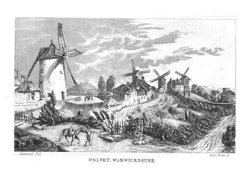
Recent research has shown this to be fraudulent and to have been taken from a French engraving of four of the windmills on Montmartre in Paris. There were thirty windmills on Montmartre and they have been the subject of many paintings by artists as well known as Renoir, Toulouse-Lautrec and Van Gogh. It was through this that the forgery was discovered.
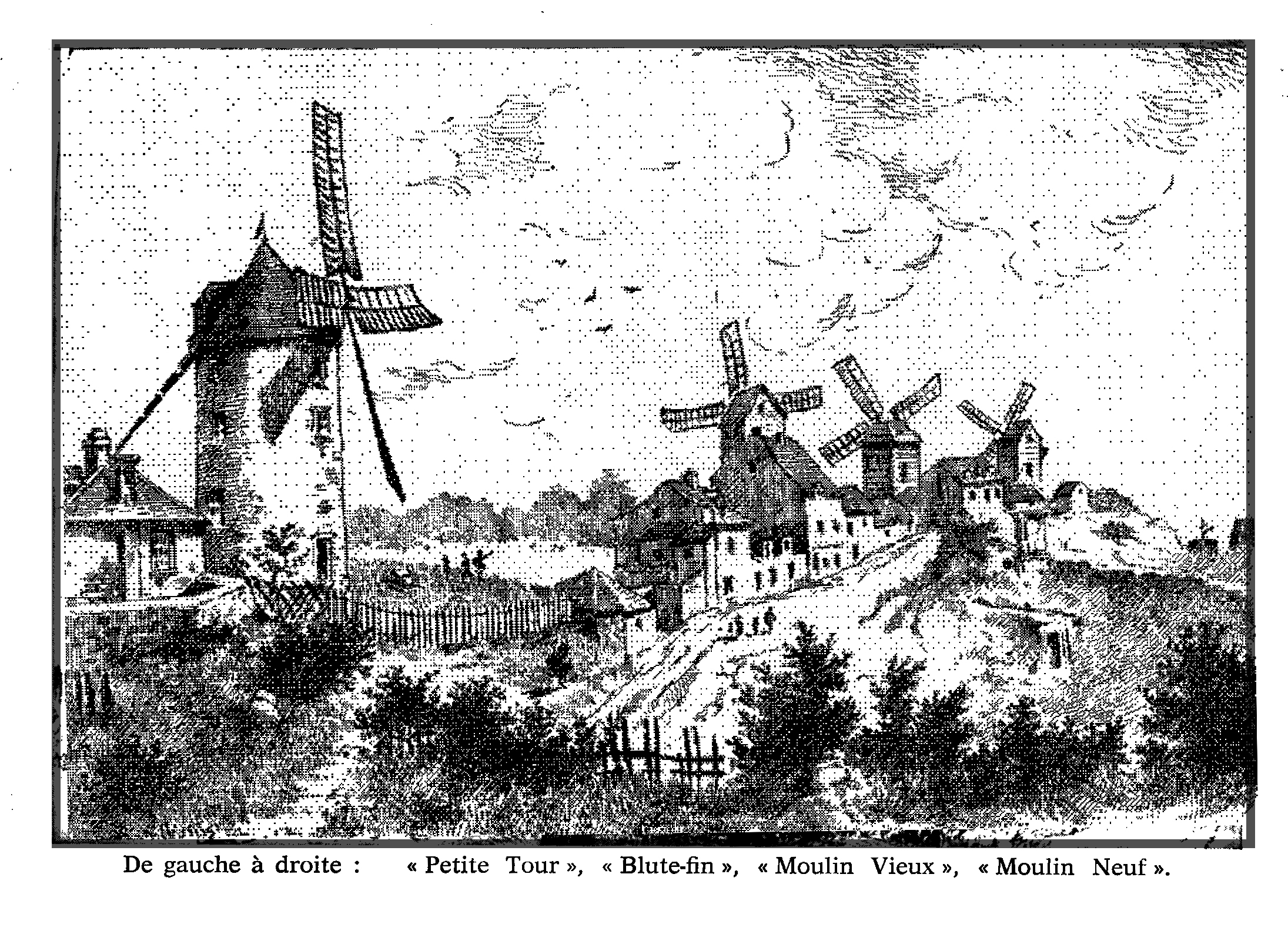
This version of the engraving is taken from Lydia Maillard's book Les Moulins de Montmartre et leurs Meuniers (p. 99). The Blute-Fin windmill still survives as a private property. It was built in 1622.